
Directions & arrival
Read this before you rely on your phone. GPS handles guiding you here and will likely get you to our front entrance, but just in case, have a look so you know what to expect.
The route
From Franklin, roughly 8 minutes.
- Patton Road — follow it out of town to Potts Branch Road.
- Potts Branch Road — where the road forks in two, Potts Branch is the one curving right. Follow it 0.5 miles in total.
- Turkey Pen Road — turn right where you see a string of black and grey mailboxes.
- Once you are on Turkey Pen Road, stay left. That is the turn people get wrong. Drive 0.3 miles from there. This stretch is a one-lane dirt road, so take it slow. You may meet a vehicle coming the other way, and there are pullouts along it for passing.
- Look for the green gate. The sign on it still reads “Bear Paw Ridge” — our own Cardinal Mountain Campground signs are going up shortly. Turn right into the entrance. Once you’re through the gate the road is freshly paved the rest of the way to your site.
- Don’t take the road left up the hill just before the entrance — that’s our neighbor’s place.
If you pass the green gate, you’ve gone too far.
What the road is like
The last stretch before the gate — the 0.3 miles along Turkey Pen Road — is one lane and unpaved. It’s an ordinary dirt road and any car will manage it; just take it slow. If you meet a vehicle coming the other way, there are pullouts along it for passing.
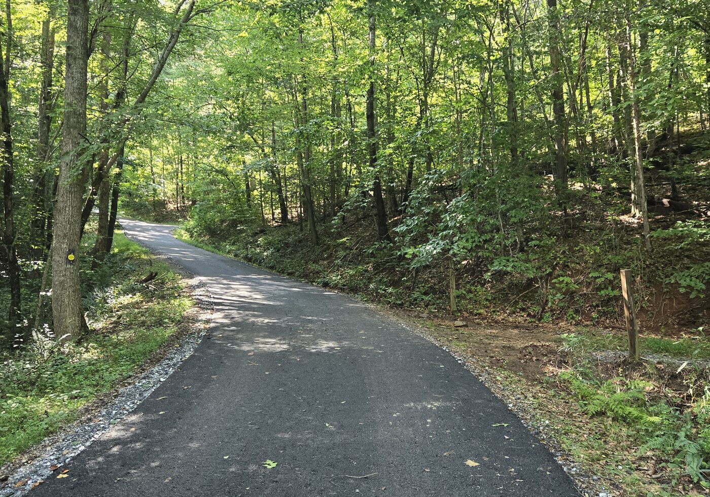
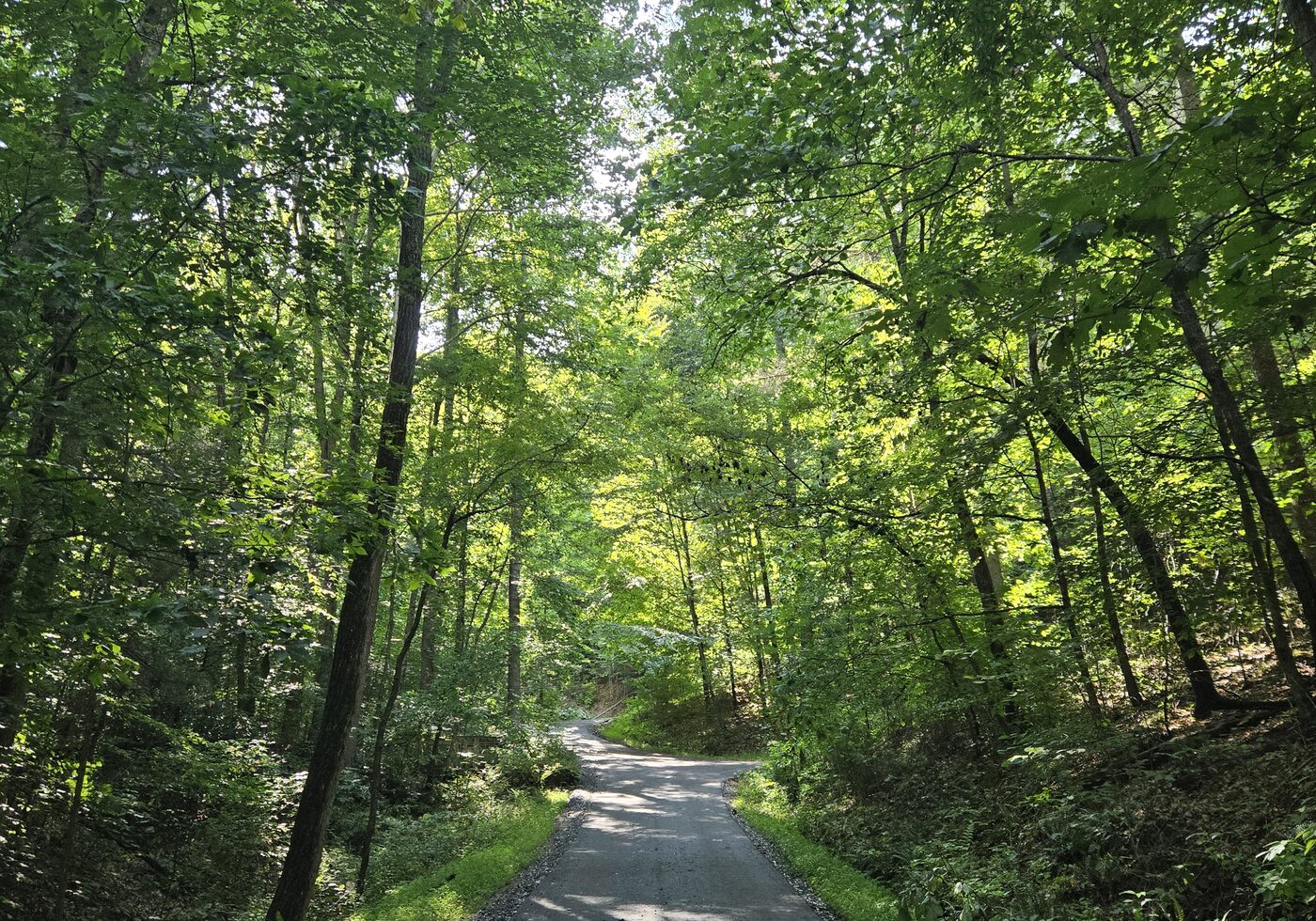
Once you’re through the gate the surface changes. The main road up the mountain is paved, apart from one short flat stretch that didn’t need it, and the corners are cut wide. Driving up is not the hard part. Take it at 7 mph, which is our posted limit and also just the sensible speed.
What sets the size limits is the room to turn around once you reach a site. A longer vehicle can generally get in and out, but it may take a few back-and-forth moves and on some sites it would be close. The lengths we list are the ones we’re confident about — and we’re happy to help if you’re not sure.
Above site 6 the road forks — right for sites 7 through 10, left for 11 through 17. Both branches are paved, apart from one short flat stretch we left as it was, and both stay the same width the whole way.
Sites 1, 5 and 6 take vehicles up to 25 feet, with wide spots on the main road nearby for a K-turn. Sites 2 and 3 take the same 25 feet, but there’s nowhere to turn a van around once you head in — most people back in on arrival. Sites 8, 9, 10, 11, 12 and 14 are good to 20 feet, 13 is good to 22, 16 and 17 are good to 18, and 7 and 15 take cars and small trucks only.
Sites 11 through 17 have no turning room at the site, so leaving one means a K-turn on the road.
Length isn’t the whole story — wheelbase and turning radius matter just as much up here. If you’re near the limit, ask us before you book.
Arriving at night? It gets very dark up here. Come with a headlamp within reach, not packed at the bottom of a bag.
Just inside the gate
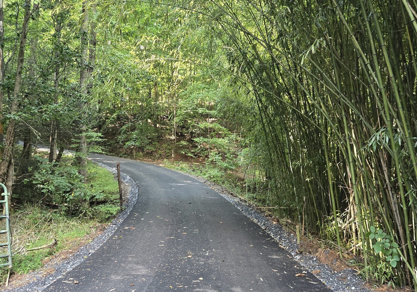
All three of these look the same way — uphill from just inside the entrance gate. That bamboo is not something people expect to find in the Blue Ridge, but it’s there, and it’s how you know you’re in the right place.
Finding your site
Once you’re through the gate, follow the numbers and arrows. Each site is marked with its number, and arrows at the junctions point the way. The roads themselves aren’t signed yet, so go by your site number rather than looking for a street name.
Know your number before you arrive — it’s on your booking, it’s how you find your way in the dark, and it’s what you give a 911 dispatcher if you ever need one.
Cell service and WiFi
There’s 5G on the mountain, so your phone should work and you can be reached. There’s also WiFi at Gleason, the community rendezvous spot between sites 4 and 5 — at that one spot, not at the sites themselves, so your phone’s signal is what you’ll use at your own. If you’re working remotely for a few days, this is a workable place to do it.
An on-site manager lives here year-round. If something goes wrong, there’s a person here.
Driving to the garbage drop-off
There are no bins on the property, so what you pack out goes to the Franklin town garbage
and recycling drop-off, under five minutes from the gate:
3030 Old Murphy Rd, Franklin, NC 28734
By landmark, if you’d rather not use the phone: back to Patton Road, turn right, then left onto Industrial Park Road after about 800 feet. Cross US-64, turn right on Old Murphy Road, and it’s a quarter mile up on the right.
The county landfill is a separate location in Franklin and is for large items only. If you’d rather not make the trip at all, there is garbage bag pickup ($10).