
The layout
Property map
Sixteen bookable sites at Cardinal Mountain Campground in Franklin, NC. Privacy, peace and quiet, and a whole lot of trees. Tap any number to see that site.
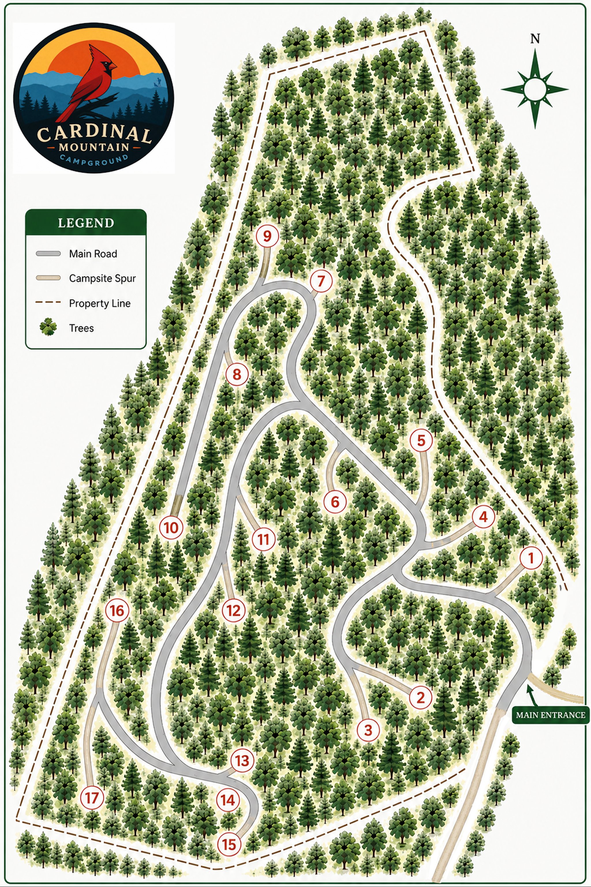
Illustrated for choosing a site. North is up, so the top of the map isn’t the top of the mountain.
The climb
From the gate to the top
The lowest site sits at 2,330 feet and the highest at 2,630 — 300 feet of climb from one end of the property to the other. That’s why it runs noticeably cooler up top than it does in town, and why the views open up as you go. Every site page and every map popup gives that site’s own elevation.
Elevations are surveyed. The slope between them is drawn for illustration.
How to read it
- Tap any number to see that site — photos, elevation, sun, what fits.
- A red dot on the number means the site has a long-range view.
- The lower numbers sit near the entrance. The higher ones climb the mountain and get quieter.
- Site 4 is grayed out. Our on-site manager lives there.